Papers

Helicopter AFMAG (ZTEM™) and aeromagnetic survey results over epithermal gold and gold-skarn deposits in the Guerrero Gold Belt, Mexico

ZTEM™ helicopter electromagnetic and aeromagnetic surveys were flown for epithermal gold and gold-skarn targets on the Aurea Norte Property in the Guerrero Gold Belt. Survey results supported by 2D-3D EM and magnetic inversions indicate that the Ana Paula mafic intrusive hosted epithermal style gold deposit features high magnetics and low resistivity at depth; whereas San Luis oxidized skarn-style deposit hosts weak magnetics with high resistivity at depth. Both trends appear to be influenced by NS regional structural controls.

Category: Case Study
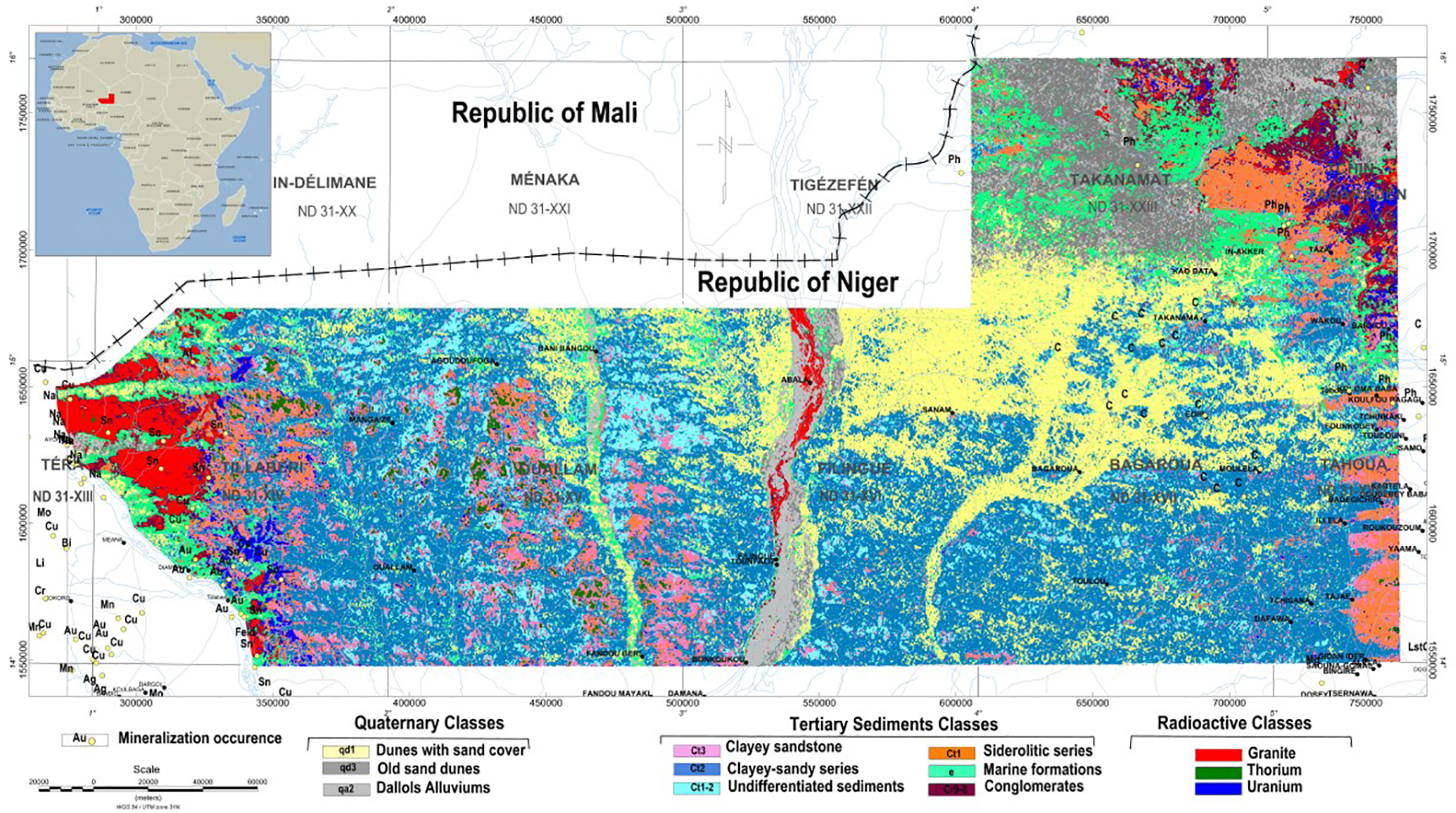
Predicted lithological map of the Iullemmeden basin

Integrating airborne geophysics with Landsat TM imagery and geology for assessing the mineral potential of the Iullemmeden Basin, Niger.

Airborne geophysical surveys, consisting of fixed-wing magnetic gradiometer and gamma-ray spectrometer and helicopter-borne full-waveform Versatile Time-Domain Electromagnetic (VTEM™) surveys were carried out over the Iullemmeden basin, in western Niger for mineral exploration and detailed geological mapping

Category: Case Study, Conference

ZTEM™ Tipper AFMAG Results over Mt. Milligan Copper-Gold Porphyry deposit

ZTEM (Z-Axis Tipper Electromagnetic) surveys were conducted, on behalf of Geoscience BC (Project 2008-32), over the Mt. Milligan Property, belonging to Terrane Metals Corp. (Vancouver, BC) and situated in the Mackenzie region of central British-Columbia (Figure 1a), between October 15TH to 22ND, 2008. The ZTEM survey comprised airborne Tipper AFMAG (audio frequency electromagnetics) measurements, as well as aeromagnetics using a caesium magnetometer. The survey consisted of twenty five (25) approx. 8.0 km long, EW oriented flight lines, totaling 200 line-km, that were obtained at nominal 250m line spacings over an approximately 6 x 8 km area .
Category: Case Study

ZTEM™ Tipper AFMAG Results over the Pebble Porphyry deposit

In September, 2009, Geotech Ltd. carried out a helicopter-borne geophysical survey for Pebble Partnership over the Pebble Property situated in the Bristol Bay region of southwest Alaska, approximately 320 km southwest of Anchorage. Principal geophysical sensors included the Z-axis Tipper Electromagnetic (ZTEM) system and caesium magnetometer. A total of 250 km were flown at a nominal line-spacing of 200m over a 60 km2 area. The objective of the ZTEM survey was test its ability to map the Pebble porphyry deposit from surface to depth, based on resistivity contrasts.

Category: Case Study
71-80 of 80<