Helicopter Time-Domain EM Results over the Wahpeton Aquifer, Fargo, North Dakota
For a PDF of this paper click here. PRESENTED AT AEM 2018 SUMMARY We present the results of …
Category: Case Study, Conference
For a PDF of this paper click here. PRESENTED AT AEM 2018 SUMMARY We present the results of …
For a PDF of this paper click here. BIOGRAPHY Tim Eadie (B.Sc. Eng.) graduated in geomatics engineering from …
For a PDF of this paper click here Summary In 2016 Geotech completed a test of a helicopter-borne …
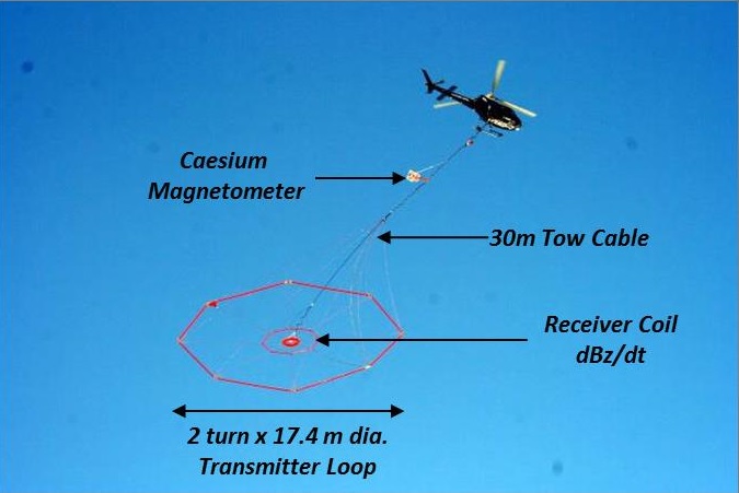
For a PDF of this paper click here Summary VTEM™ is a helicopter-borne time-domain electromagnetic (TDEM) system designed …
For a PDF of this paper click here Introduction Introducing the Full Waveform VTEM™ system, the most recent …
For a PDF of this paper click here Summary The amount of multi-disciplinary (geology, geophysics, remote sensing, etc.) …
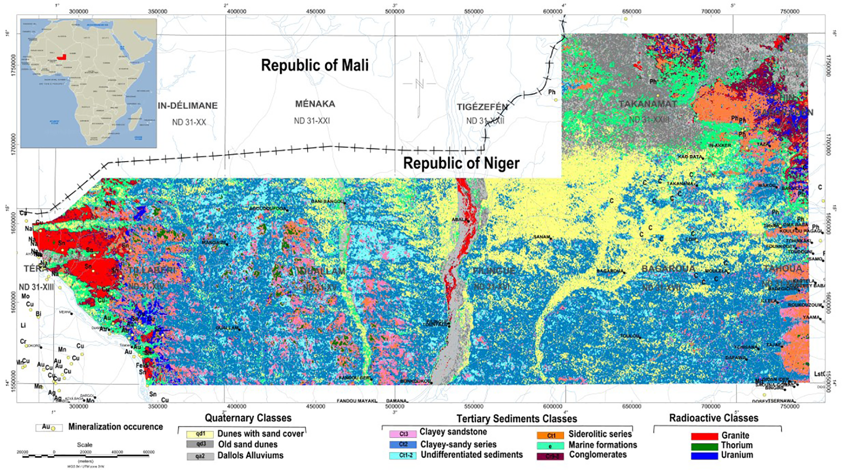
Airborne geophysical surveys, consisting of fixed-wing magnetic gradiometer and gamma-ray spectrometer and helicopter-borne full-waveform Versatile Time-Domain Electromagnetic (VTEM™) surveys were carried out over the Iullemmeden basin, in western Niger for mineral exploration and detailed geological mapping