The survey will fly along a series of widely spaced parallel profiles spanning over 1500 miles. The following is a description of the project provided by the U.S. Geological Survey:
Beginning in early April and continuing for approximately two weeks, the U.S. Geological Survey will conduct an aerial survey designed to scan the upper part of the earth’s crust.
The survey will determine how well different rocks conduct electricity and ultimately help refine geologic maps of an area with significant mineral potential.
The survey is targeting a suite of rocks deposited 1.8 billion years ago in a deep-water marine environment when the region lay at the edge of a vast ocean. These rocks are a potential source of sulfur for many types of mineral deposits found throughout the region and have been mapped only at the surface throughout the survey area.
“The high electrical conductivity of these particular rocks makes them an ideal target for airborne electromagnetic studies,” said USGS scientist Paul Bedrosian, the study’s lead investigator. “This survey will enable us to map the geometry of these rocks deep into the subsurface.”
Mobilization for this survey is currently underway. We encourage interested companies working in the region to contact us if they would like to take advantage of our proximity this spring.
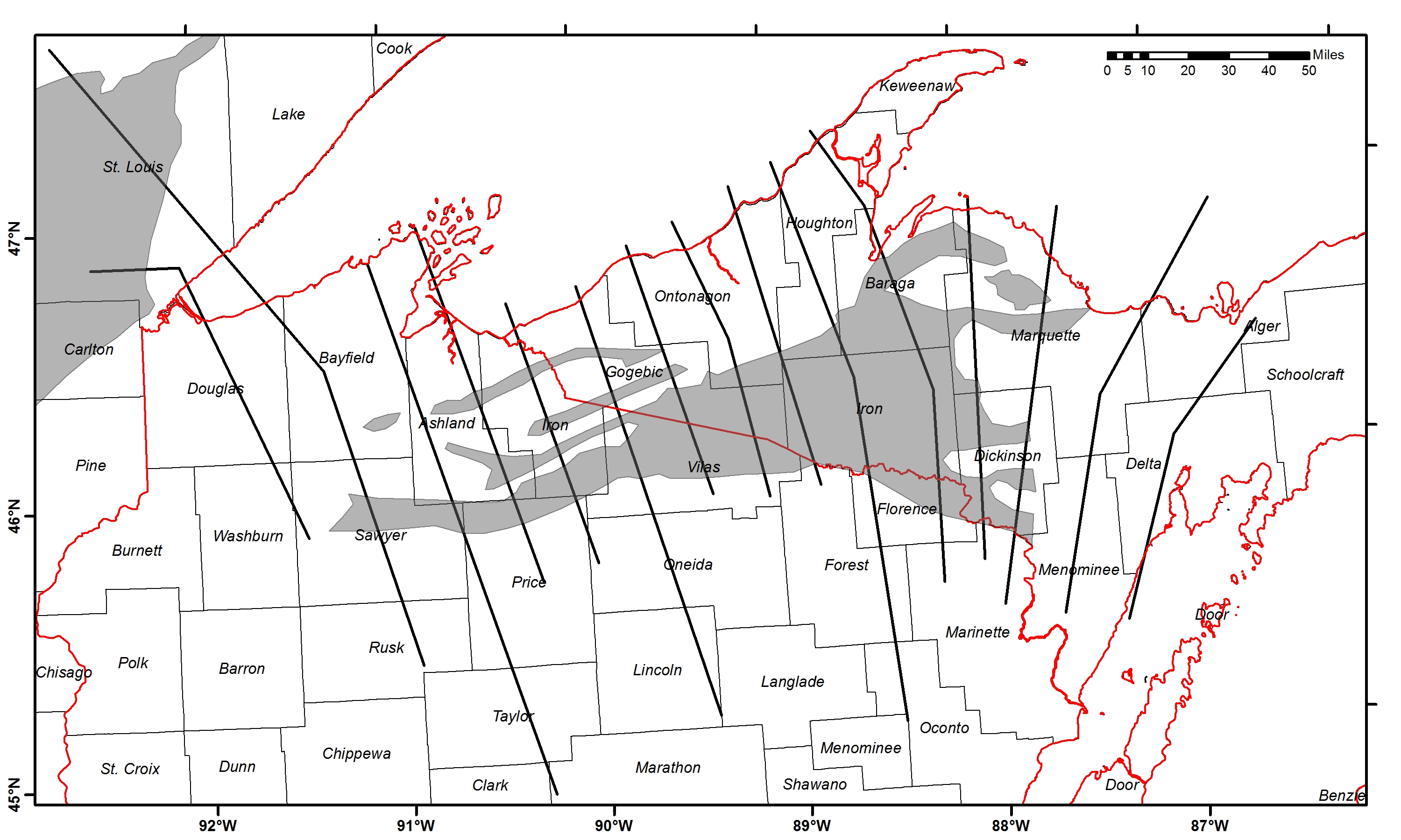
Map of upcoming USGS AEM study area in relation to state and county borders. The thick black lines are the intended flight profiles, and the shaded grey regions show the mapped extent of rocks deposited some 1.8 billion years ago. Mapping the subsurface geometry and distribution of these rocks is the primary goal of this survey.
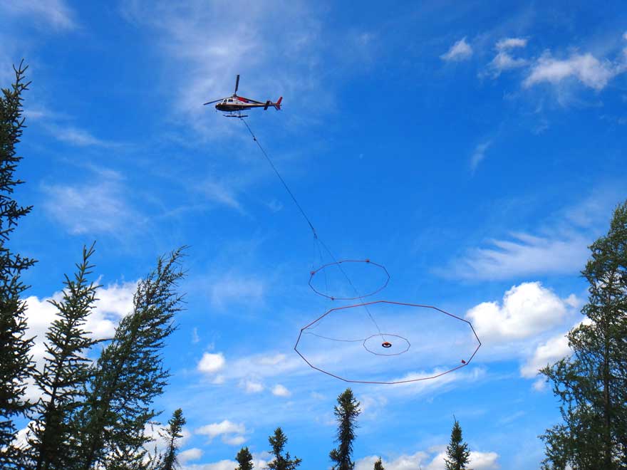
Image of the VTEM Plus AEM system from Geotech Ltd. in flight. A similar system will be flown during the upcoming USGS AEM study. Image courtesy Geotech Ltd.
To see the media advisory from the U.S. Geological Society, visit this link.