For a PDF of this paper click here
Introduction
The Coulon project is owned by Virginia Mines, a mining exploration company based in Quebec City. In 2003, they discovered their first polymetallic showing within an unexplored Archean volcanic belt in the James Bay area of Quebec, Canada (Figure 1). In the past several years, as many as seven important polymetallic lenses have been defined by Virginia Mines along a lateral distance of over 20 kilometres, confirming the potential of the Coulon belt for massive sulphide-type mineralization.
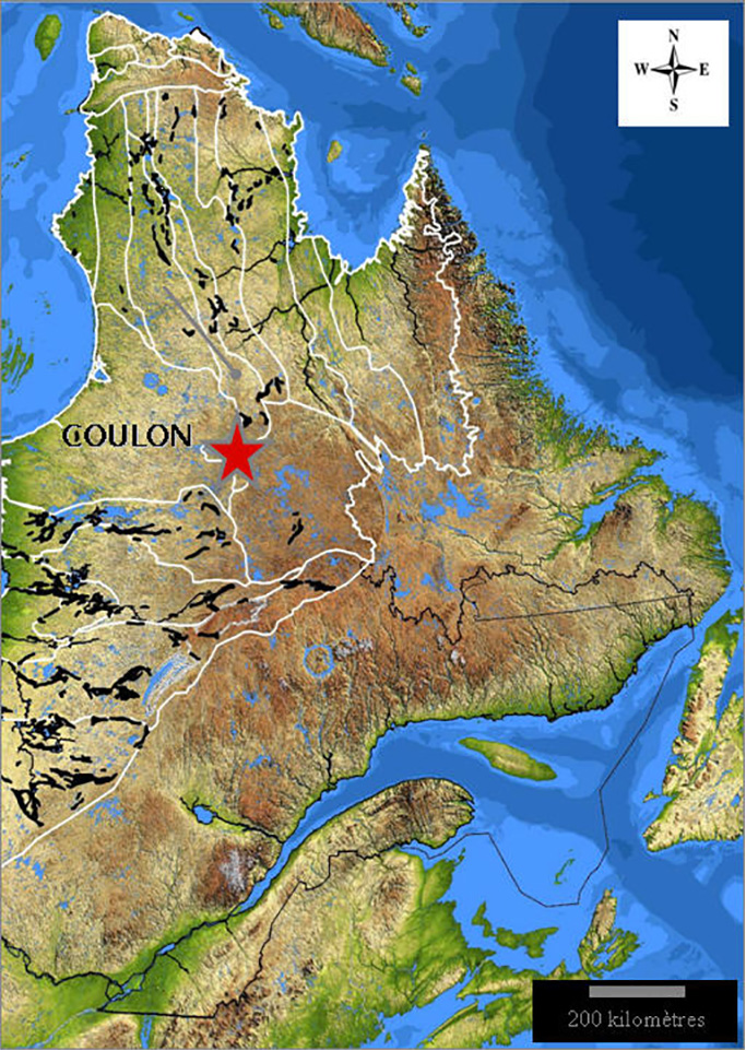
Figure 1: Location of the Coulon Project in north-central Quebec
The Coulon belt is dominated by a sequence of mafic to felsic volcanic units surrounded by metasediment and gneissic for-mations.
The original discovery (Lens 16-17 showing) was made by Virginia Mines in 2003 through prospecting. Between 2004 to 2008, a combination of geophysical and geological follow-up lead to the discovery of Lens 08, 9-25, 16-17, 44, 43, SPIRIT and lens 201 (Figure 2).
Globally, the exploration geophysical strategy was divided into two periods 2003-2005 and 2006-2008. Each strategy was based on different levels of geological knowledge and exploration objectives. The content of this paper exposes the evolution of these exploration strategies; from surface to depth, with particular emphasis on the helicopter-borne surveys.
2003-2005
The geophysical exploration strategy of this period was influ-enced by the discovery of the original Lens 16-17 showing at surface.
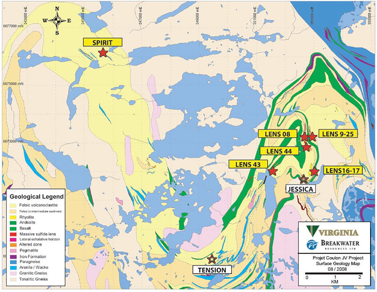
Figure 2: Geology and main ore occurrences at Coulon project.
In 2003, a helicopter-borne EM-MAG survey of 2,790kms was completed over the original prospective ground. A VERSATEM system, an early VTEM system prototype (18m transmit loop; 140k NIA peak dipole moment) was used for this survey (Figure 3).
Ground follow-up of the VERSATEM survey was conducted using the horizontal loop EM (HLEM) technique (MaxMin I, Tx-Rx=100m, 5 frequencies) and magnetics (Figure 4). Finally, several fixed-loop (DEEP-EM) and borehole TDEM (Pulse-EM) surveys close to the original discoveries were also completed.
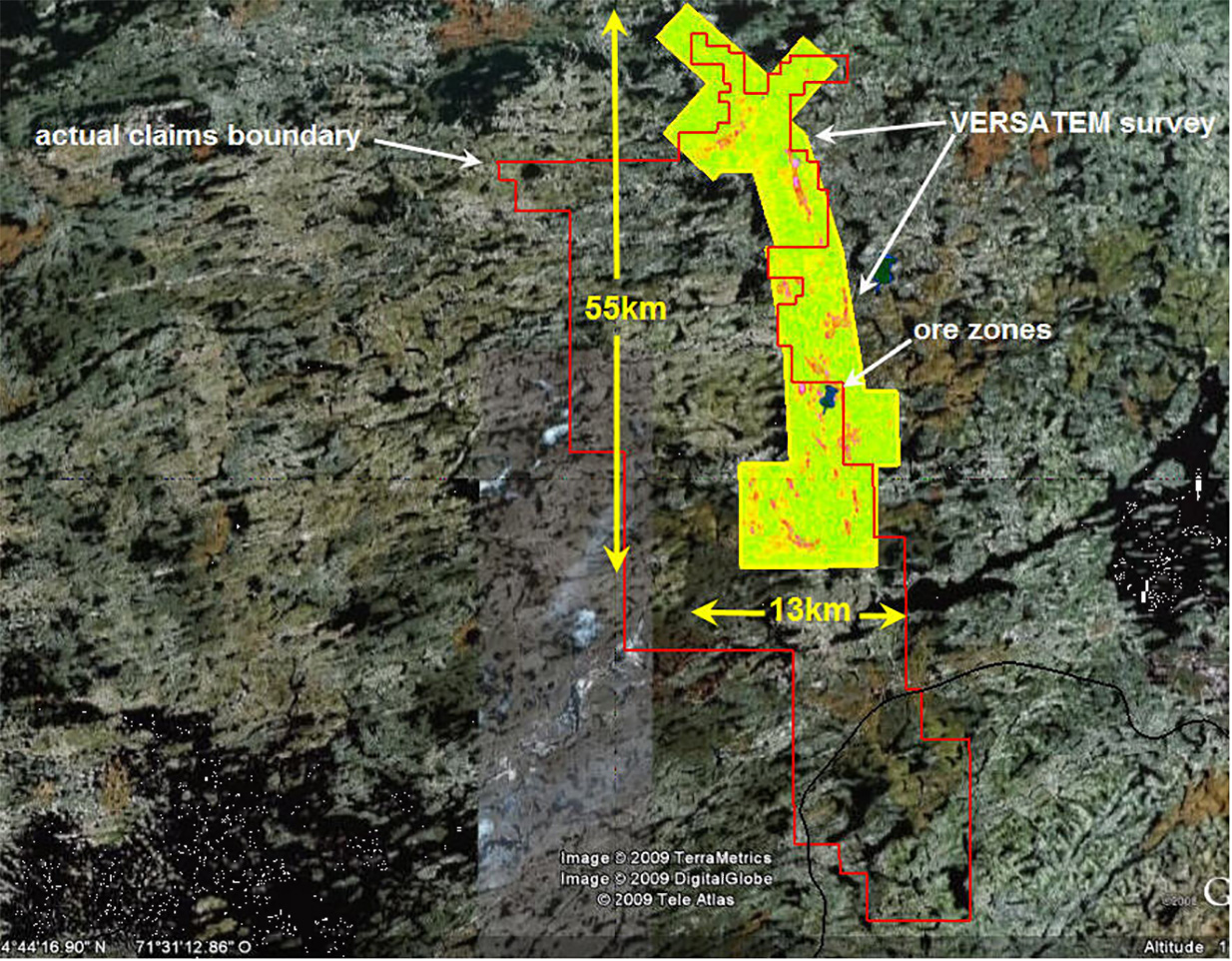
Figure 3: 2003 VERSATEM Hz (234us) vs. actual claim boundary.
During this period, the geophysical strategy coupled with ag-gressive drilling campaigns lead to the discovery of lens 08, 9-25. At the end of 2005, with limited ore resources and a lack of new targets, the Coulon project was put on hold.
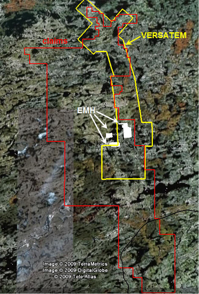
Figure 4: Horizontal loop EM (EMH) coverage vs. VERSATEM & claims
2006-2008
In 2006, the discovery of Lens 44 by deep drilling and access to new geophysical technologies (InfiniTEM and VTEM) ensured a second chance for the Coulon project. The definition of larger prospective geology and the novel potential for deeper discoveries paved the road for a renewed geophysical strategy.
During this period, over 422km of a new, deep-penetrating, fixed-loop TDEM method, InfiniTEM, was carried out (Figure 5). This approach lead to the discovery of new ore zones, including Lens 43, a deep and buried VMS lens.
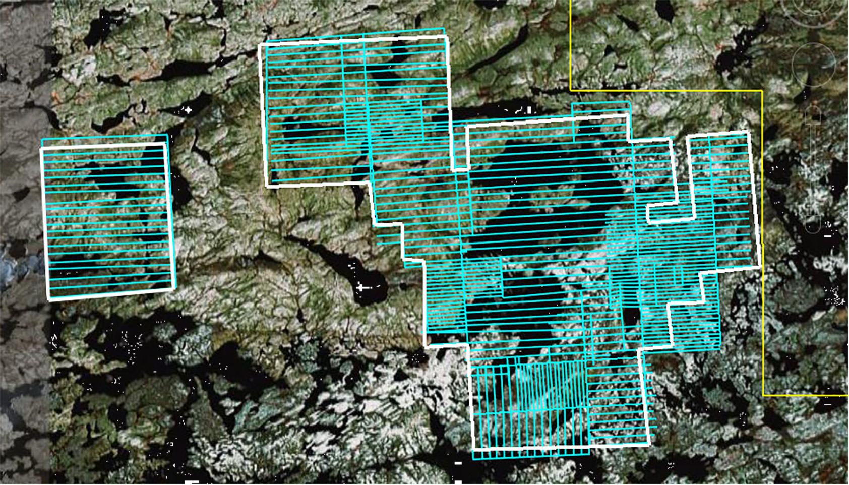
Figure 5; Fixed loop InfiniTEM coverage at Coulon project
In 2007, Geotech flew over 6,100km of the current VTEM sys-tem (26m transmit loop, 425k NIA peak dipole moment) (Figure 6). This survey mainly covered new prospective terrain but also overlapped with the previous VERSATEM survey, including the lens 43 discovery. The difference in the technical specification for both survey is illustrated in Table 1.
| PARAMETER | VERSATEM (2003) | VTEM (2007) |
| Transmitter coil diameter: | 18.5 m | 26 m |
| Number of turns: | 5 | 4 |
| Transmitter frequency: | 30 Hz | 30 Hz |
| Peak current: | 110 A | 205 A |
| Pulse width: | 7.5 ms | 7.2 ms |
| Peak dipole moment: | 140,000 NIA | 435,350 NIA |
Table 1: Time domain EM system technical specifications.
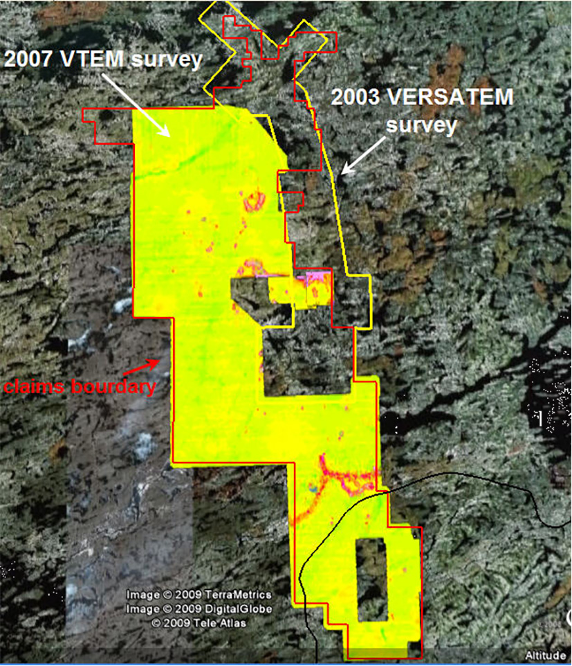
Figure 6: 2007 VTEM survey coverage and Hz (225us) grid contours
The overlap of the two airborne surveys clearly illustrates the significant improvements in technology of the VTEM system, most noteably over Lens 43. This deep ore zone was missed by the VERSATEM but was clearly visible in the results of the VTEM survey (Figure 7 and Figure 8). This represents a major improvement in depth investigation since the Lens 43 had been intersected below 125 vertical meters from the surface.
Numerical modeling of the VTEM response using EMIT Max-well software shows a gently dipping plate buried at 80m below surface (Figure 9).
*Fig 7,8, 9
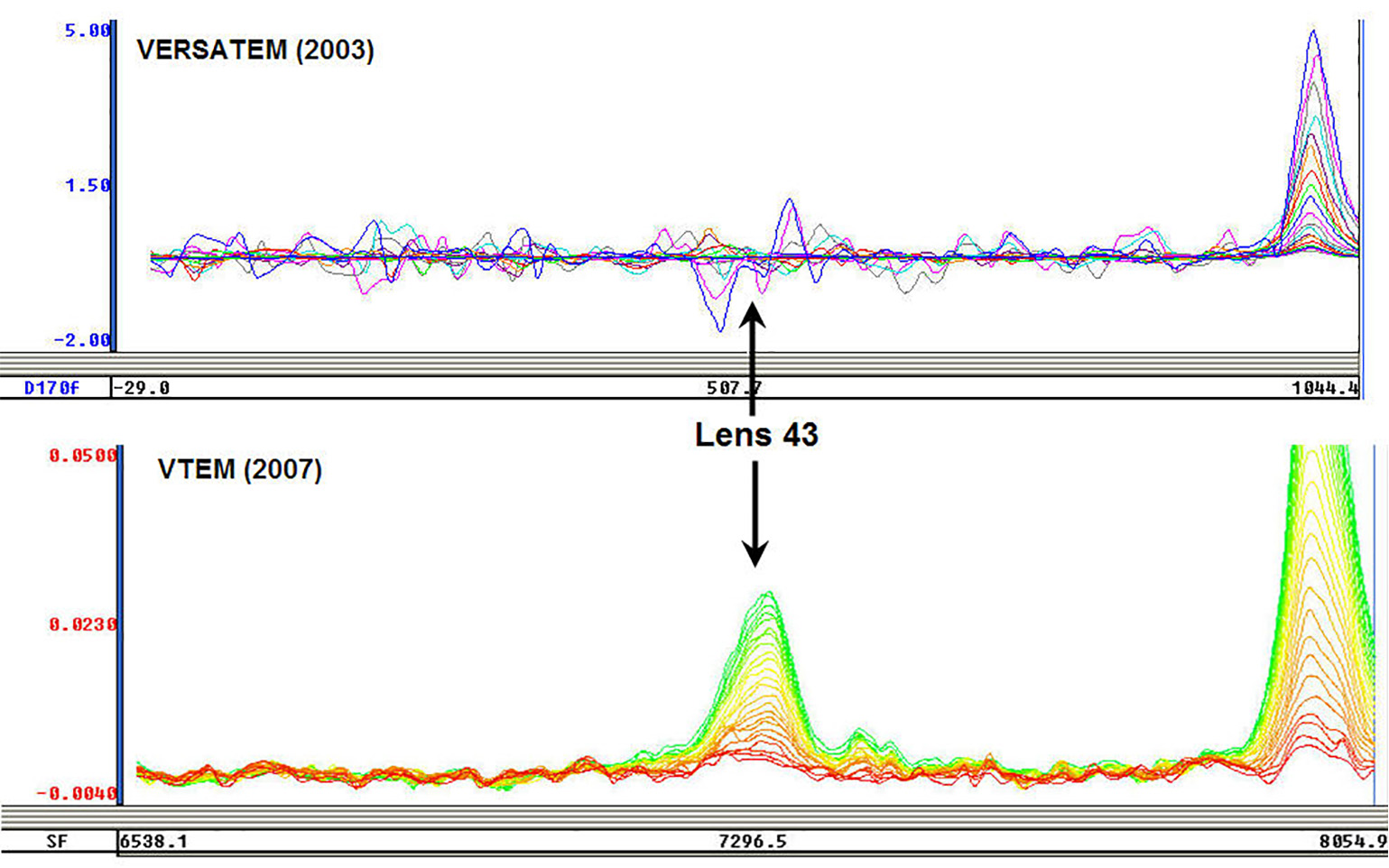
Figure 7: VERSATEM vs. VTEM profiles over Lens 43
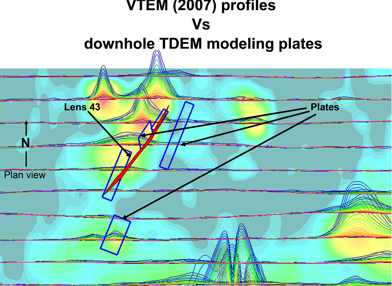
Figure 8: VTEM profiles and downhole EM plate models over Lens 43.
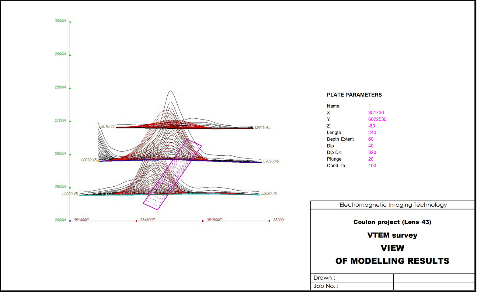
Figure 9: Maxwell modeling of the VTEM results over Lens 43.
Conclusion
The 2007 VTEM EM-MAG survey showed numerous conduc-tive shallow and deep anomalies over a new prospective envi-ronment for VMS within the Coulon project. Ground follow-up using recent advances in geophysical tools lead to the discov-ery of several new base metal showings and ore zones (Figure 9).
The improvements of the VTEM system (26m transmit loop, 425k NIA peak dipole moment) have been amply demonstrated over Lens 43 of the Coulon project. This demonstrated how inclusion of advances in geophysical technologies as part of an exploration strategy can improve findings in unexplored but prospective geological environments.
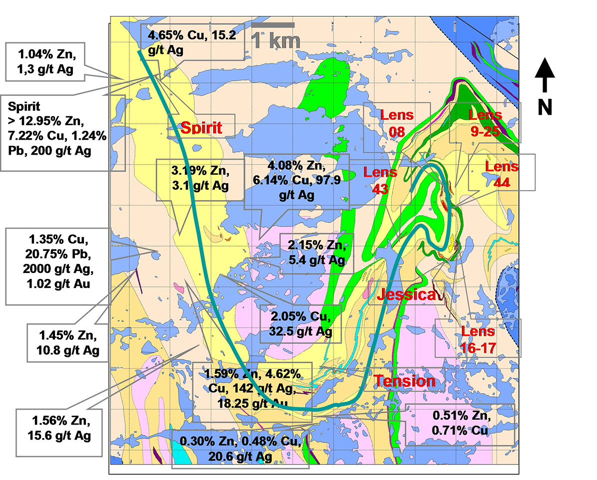
Figure 10: VMS showings and ore deposits on the Coulon project
Acknowledgements
We wish to thank MB Geosolutions, Geotech and Virginia Mines for allowing us to present these results.